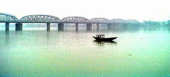
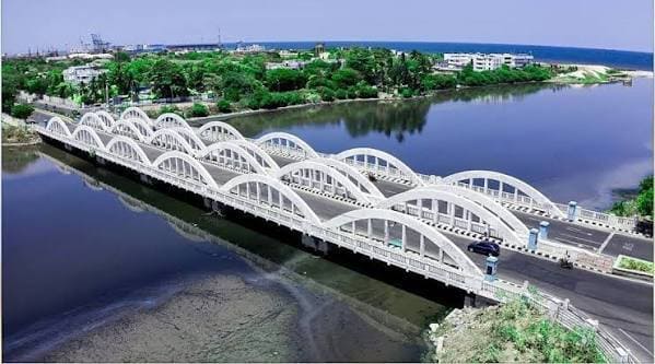
Napier Bridge, also known as Cooum Bridge, is one of the oldest and most iconic bridges in Chennai, Tamil Nadu. Built in 1860, it is a historic stone arch bridge that spans the Cooum River, connecting Anna Salai (Mount Road) with Kamarajar Salai near the Marina Beach.
With its elegant colonial-era architecture and picturesque setting, Napier Bridge is a favourite photography spot, especially during sunrise and sunset. It serves as a vital road link in South Chennai while holding significant heritage value.
Napier Bridge Location
Napier Bridge crosses the Cooum River at the point where it meets the Bay of Bengal, in the heart of Chennai’s heritage and commercial zone.
- Address: Napier Bridge, Cooum River, Anna Salai – Kamarajar Salai, Chennai, Tamil Nadu
- PIN Code: 600002
- Length: Approx. 138 metres
- Type: Stone Arch Bridge
- Built: 1860 (during British colonial period)
- Significance: Historic landmark and one of Chennai’s oldest bridges
How to Reach Napier Bridge
| From | Distance | Approx. Time | Best Options |
| Chennai Central Railway Station | 4–5 km | 15–25 minutes | Cab, Metro, Bus |
| Egmore Railway Station | 6–7 km | 20–30 minutes | Cab / Bus |
| Marina Beach | 1–2 km | 5–10 minutes | Walking / Auto |
| Fort St. George | 2–3 km | 8–15 minutes | Cab / Auto |
| Chennai International Airport | 18–20 km | 40–60 minutes | Cab / Taxi |
| Parthasarathy Temple (Triplicane) | 3–4 km | 10–20 minutes | Auto / Cab |
Road & Bridge Connectivity
- Connects the busy Anna Salai with Kamarajar Salai (Beach Road).
- Part of the important South Chennai road network.
- One-way traffic system is followed on the bridge.
- Excellent public transport connectivity with MTC buses and proximity to Chennai Central Metro Station.
- The bridge offers beautiful views of the Cooum River mouth and the Bay of Bengal.
Nearby Areas and Landmarks
| Landmark / Area | Distance | Description |
| Marina Beach | 1–2 km | Chennai’s iconic 13-km long beach. |
| Cooum River Estuary | Beneath the bridge | Scenic river meeting the sea. |
| Fort St. George | 2–3 km | Historic British-era fort and museum. |
| Madras High Court | 2–3 km | Beautiful colonial architecture. |
| Chepauk Cricket Stadium | 3–4 km | Historic cricket ground. |
| Government Museum (Egmore) | 5–6 km | One of India’s oldest museums. |
| Parthasarathy Temple | 3–4 km | Ancient Vishnu temple. |
Significance
Napier Bridge is not just a transportation link but a heritage icon of Chennai. Named after Sir Charles James Napier, it has witnessed over 160 years of Chennai’s history. The bridge is especially beautiful when illuminated at night and during the early morning hours when the river and sea create a serene backdrop. It remains a favourite spot for filmmakers, photographers, and tourists exploring Chennai’s colonial and coastal heritage.
Frequently Asked Questions (FAQs)
Q1. When was Napier Bridge built?
A. It was constructed in 1860 during the British colonial period.
Q2. What is special about Napier Bridge?
A. It is one of Chennai’s oldest bridges with beautiful stone arch architecture and scenic views of the Cooum River and Marina Beach.
Q3. Can vehicles cross Napier Bridge?
A. Yes, it is open for vehicular traffic (one-way system).
Q4. What is the best time to visit Napier Bridge?
A. Early morning or evening for pleasant weather and beautiful photography, especially at sunrise and sunset.
Q5. Is Napier Bridge a good tourist spot?
A. Yes, it is a popular heritage and photography spot, especially when combined with a visit to Marina Beach and Fort St. George.