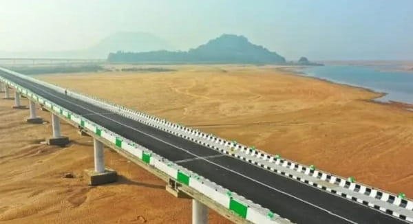
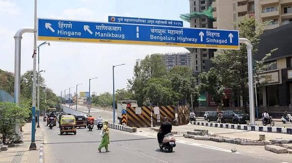
Warje Bridge — the prominent road bridge and daily transit reference junction on National Highway 48 (NH-48 / Mumbai–Bengaluru Highway) over the Mutha River in the Warje Malwadi zone of southwestern Pune — is one of the busiest and most practically essential bridge junctions in Pune’s expanding western residential corridor, serving as the primary gateway for thousands of daily commuters travelling between the Warje–Malwadi–Kothrud residential belt and the main highways leading south toward Katraj and Mumbai–Bengaluru. Located in PIN 411052 / 411058, the Warje Bridge stands at the convergence of the National Highway, the internal Warje Malwadi residential road network, and the Mutha River crossing — flanked by major residential developments, educational institutions, the Cipla Centre, and a dense commercial ecosystem that has grown up around one of Pune’s most convenient NH-adjacent residential zones.
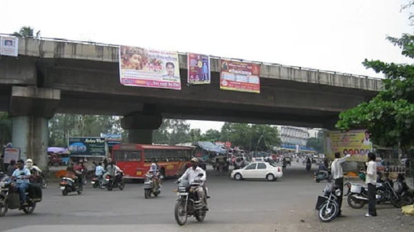
Warje as a neighbourhood has seen extraordinary growth over the past decade — with large housing townships, IT office complexes, and the Cipla pharmaceutical campus all drawing thousands of new residents and workers to the Warje–Malwadi belt. The bridge and its immediate junction area serve as the daily commuter bottleneck and navigational reference for this entire corridor. Vanaz Metro Station on Pune Metro’s Aqua Line is approximately 1.5 to 2 kilometres away — a 20-minute walk or 5-minute auto-rickshaw ride — providing Metro access to the Warje Bridge zone for commuters heading toward Pimpri-Chinchwad, Nashik Phata, and the central Pune city zone. The first PMPML bus near Warje Bridge (Route RT-7 / Ratrani) departs at 4:37 AM and the last (Route 98) runs until 1:32 AM — near-24-hour service that serves the bridge’s dense residential catchment around the clock.
Warje Bridge Location
Warje Bridge is on National Highway 48 (Mumbai–Bengaluru Highway) over the Mutha River, Warje Malwadi, Haveli Taluka, southwestern Pune — the primary NH-48 crossing point for the Warje–Kothrud–Malwadi zone.
- Address: Warje Bridge, National Highway 48, Warje Malwadi, Warje, Pune, Maharashtra — 411052 / 411058
- Pin Code: 411052 / 411058
- STD Code: 020
- Administrative Zone: Haveli Taluka / Warje Malwadi Ward — Pune Municipal Corporation / Kothrud Assembly Constituency
| Reference Point | Distance |
| Rahul Park Gate Bus Stop | Adjacent — 1-minute walk |
| Cipla Centre / Atul Nagar | Adjacent |
| Warje Malwadi Gaon | 795 metres — 11-minute walk |
| Malwadi Bus Stop | 891 metres — 12-minute walk |
| Ishan Nagari | 1.7 kilometres |
| Vanaz Metro Station (Aqua Line) | 1.5 to 2 kilometres — 20-minute walk / 5-minute auto |
| Warje Gaon (Ganpati Matha) | 1 kilometre |
| Kothrud Stand | 2 kilometres |
| Sinhagad Road | 1.5 kilometres |
| Pune Junction Railway Station | 10 to 12 kilometres |
| Khadakwasla Dam | 8 kilometres |
| Pune International Airport | 25 kilometres |
| Mumbai (via NH-48) | 165 kilometres |
Directions to Warje Bridge
Warje Bridge is directly on NH-48 — Pune’s most important southern highway artery — accessible from central Pune via multiple routes and from Kothrud, Sinhagad Road, and the Mutha River corridor.
From Pune Junction Railway Station
Take Sinhagad Road southwestward from Kothrud → continue toward Warje → approximately 10 to 12 kilometres — 25 to 35 minutes by PMPML bus or auto-rickshaw.
From Swargate Bus Stand
Take NH-48 or Karve Road southwestward → approximately 8 kilometres — 20 to 30 minutes by PMPML bus Routes 64 or 82.
From Deccan Gymkhana
Take Karve Road southward → continue via Kothrud → Warje Bridge → approximately 7 kilometres — 18 to 25 minutes.
From Vanaz Metro Station (Aqua Line)
Exit Metro → take auto-rickshaw southwestward → approximately 1.5 to 2 kilometres — 5 minutes.
From Mumbai (via NH-48)
Drive southeast on NH-48 → pass Katraj Tunnel → continue into Pune → Warje Bridge is on the right-hand side entry approach — approximately 165 kilometres from Mumbai — 3 to 3.5 hours.
Road Connectivity Warje Bridge
Warje Bridge commands a strategically powerful road position at the NH-48 Mutha River crossing in southwestern Pune — connecting the city’s residential western corridor to the national highway.
| Road | Direction | Connectivity |
| NH-48 (Mumbai–Bengaluru Highway) — North | North toward city | Sinhagad Road, Kothrud, Deccan Gymkhana, Pune Station |
| NH-48 (Mumbai–Bengaluru Highway) — South | South toward Katraj | Katraj, Navale Bridge, Satara, Kolhapur, Bengaluru |
| Warje Malwadi Road | Internal | Warje Malwadi residential belt, Ganpati Matha zone |
| Mutha River Road (along bank) | East | Vanaz, Kothrud residential areas |
| Sinhagad Road connector | East via Kothrud | Kothrud, Deccan Gymkhana, PMPML depot zone |
| Cipla Centre Road | Adjacent | Cipla Campus, Atul Nagar residential zone |
PMPML Bus Connectivity Warje Bridge
Warje Bridge is a major PMPML hub in southwestern Pune — with near-24-hour bus service covering routes to all major parts of the city and served by the Ganpati Matha PMPML Depot which provides high-frequency departures.
| PMPML Route | Service Details |
| Route RT-7 (Ratrani Night Bus) | First bus near Warje Bridge at 4:37 AM — last at 2:19 AM — near-24-hour |
| Route 98 | Last regular bus at Warje Bridge at 1:32 AM |
| Routes 64 / 64A | Via Warje Bridge — Bhekrai Nagar to NDA Gate No.10 |
| Routes 82 / 82A | Via Warje Bridge — Kothrud to Warje Malwadi corridor |
| Routes 80 / 80A | Via Warje Bridge — Manapa Bhavan / Rahul Park services |
| Routes 43 / 43A / 44 / 45 | Via Warje Bridge — Katraj zone and city centre connections |
| Routes 66 / 72 / 78 / 91 | Via Warje Bridge — cross-Pune connectors |
| Routes 202 / 276A / 276C | Via Warje Pul / Warje Bridge zone — Vasna–Warje corridor |
| Route 228 | Via Warje Bridge — south Pune services |
| Routes K7 / K7A | Via Warje Bridge — Kothrud depot special services |
| Route 97 (PMPML) | Warje Malwadi to Sahakar Nagar — 4 trips daily |
First PMPML bus: Route RT-7 at 4:37 AM. Last PMPML bus: Route 98 at 1:32 AM.
Metro Connectivity Warje Bridge
| Station | Line | Distance | Notes |
| Vanaz Metro Station | Aqua Line (Line 1 — Vanaz–Ramwadi) | 1.5 to 2 km — 5-min auto / 20-min walk | Nearest Metro — Aqua Line |
First Aqua Line Metro at Vanaz: 6:00 AM. Last Aqua Line Metro: 11:36 PM. The Aqua Line connects Warje Bridge zone northward to Anandnagar, Garware College, Deccan Gymkhana, Civil Court, Shivajinagar, and onward to Ramwadi — a full cross-city corridor through central Pune. A Phase 2 Metro extension from Vanaz to Paudphata via Warje is planned by 2028, which will bring a Metro station directly to the Warje Bridge zone.
Railway Connectivity Warje Bridge
| Station | Distance | Line | Notes |
| Pune Junction Railway Station | 10 to 12 km | Central Railway | Main Pune terminus — all express trains |
| Shivajinagar Railway Station | 9 km | Central Railway | Secondary suburban halt |
Nearby Areas and Landmarks Warje Bridge
| Landmark / Area | Distance | Description |
| Cipla Centre / Atul Nagar | Adjacent | Cipla pharmaceutical campus — major employment hub at Warje Bridge |
| Warje Malwadi Gaon | 795 metres | Primary residential village neighbourhood adjacent to the bridge |
| Khadakwasla Dam | 8 km | Pune’s beloved lakeside picnic destination on the Mutha River |
| Sinhagad Fort | 18 km | Pune’s legendary Maratha hilltop fort |
| Vanaz | 1.5 km | Established residential area — Metro terminal |
| Kothrud | 2 km | One of Pune’s largest and most developed residential zones |
| Rajaram Bridge (Kothrud) | 2 km | Secondary Mutha River crossing |
| Pune–Okayama Friendship Garden | 6 km | Largest Japanese-style garden in Pune |
Frequently Asked Questions (FAQs)
Q1. Where is Warje Bridge located in Pune?
A: Warje Bridge is on National Highway 48 over the Mutha River, Warje Malwadi, Haveli Taluka, Pune — PIN 411052 — approximately 10 to 12 kilometres from Pune Junction Railway Station and 165 kilometres from Mumbai.
Q2. Which Metro station is nearest to Warje Bridge?
A: Vanaz Metro Station on the Aqua Line (Line 1) is approximately 1.5 to 2 kilometres away — a 5-minute auto-rickshaw ride or 20-minute walk. First Metro: 6:00 AM; last: 11:36 PM. A Phase 2 Aqua Line extension directly to Warje is planned by 2028.
Q3. Which PMPML routes serve Warje Bridge?
A: Routes RT-7, 64, 64A, 82, 80, 80A, 43, 44, 45, 66, 72, 78, 91, 98, 202, 228, 276A, 276C, K7, and K7A serve the bridge zone. Route RT-7 starts at 4:37 AM and Route 98 runs until 1:32 AM.
Q4. Is Cipla’s campus near Warje Bridge?
A: Yes. The Cipla Centre / Atul Nagar is directly adjacent to Warje Bridge — one of the largest pharmaceutical campuses in Pune, making Warje Bridge a daily transit reference for thousands of Cipla employees.
Q5. How far is Khadakwasla Dam from Warje Bridge?
A: Approximately 8 kilometres southward along the Mutha River corridor — a 15 to 20-minute drive — making Warje Bridge an excellent pit stop en route to Khadakwasla and Sinhagad Fort.