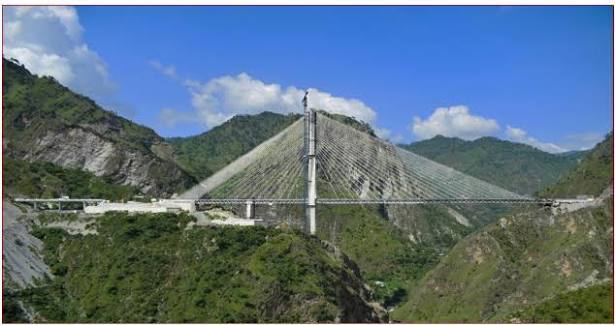
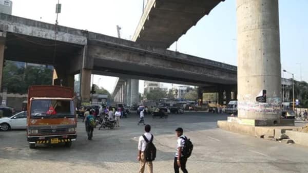
Atal Setu, officially known as the Atal Bihari Vajpayee Sewri–Nhava Sheva Atal Setu (also called Mumbai Trans Harbour Link or MTHL), is India’s longest sea bridge. This engineering marvel stretches 21.8 km (with 16.5 km over the sea) and connects Sewri in South Mumbai to Chirle in Navi Mumbai.
Inaugurated by Prime Minister Narendra Modi on 12 January 2024, the 6-lane bridge has dramatically reduced travel time between Mumbai and Navi Mumbai from nearly 2 hours to just 20–25 minutes. It is the 12th longest sea bridge in the world and a game-changer for connectivity in the Mumbai Metropolitan Region.
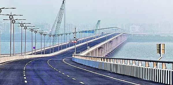
Atal Setu Location
Atal Setu spans the Arabian Sea (Thane Creek) north of Elephanta Island. It starts at Sewri in South Mumbai and ends at Chirle near Nhava Sheva (JNPT) in Uran taluka, Navi Mumbai.
- Address: Atal Bihari Vajpayee Sewri–Nhava Sheva Atal Setu, Mumbai–Navi Mumbai
- PIN Code: Varies (Sewri: 400015 | Chirle/Nhava Sheva: 410206)
- Length: 21.8 km (6-lane expressway)
- Significance: India’s longest sea bridge, vital link for Mumbai–Navi Mumbai–Pune connectivity
How to Reach Atal Setu
| From | Distance / Access Point | Approx. Time | Best Options |
| Sewri (Mumbai End) | Starting Point | Immediate | Eastern Freeway, Direct entry |
| Chirle / Nhava Sheva (Navi Mumbai) | Ending Point | Immediate | NH-348, JNPT Road |
| Mumbai Airport (T1/T2) | 18–22 km | 25–40 minutes | Cab / Taxi via Eastern Freeway |
| Navi Mumbai International Airport | Under development (close) | 10–15 minutes | Direct future connectivity |
| Pune (via Mumbai-Pune Expressway) | Connected | Significantly reduced | Direct link via upcoming corridors |
| Bandra / South Mumbai | 10–15 km | 20–30 minutes | Coastal Road + Atal Setu |
| Thane / Eastern Suburbs | 15–25 km | 25–40 minutes | Via Eastern Express Highway |
Road & Bridge Connectivity
- 6-lane bidirectional expressway with emergency lanes
- Connects to Eastern Freeway (Mumbai side) and Mumbai–Pune Expressway (Navi Mumbai side)
- Major interchanges at Sewri, Shivajinagar (Ulwe), and Chirle
- Links to Jawaharlal Nehru Port (JNPT), upcoming Navi Mumbai International Airport, and Coastal Road
- Designed for 70,000 vehicles per day
Nearby Areas and Landmarks
| Landmark / Area | Distance / Side | Description |
| Sewri Fort & Flamingo Sanctuary | Mumbai End (nearby) | Historic fort and popular birdwatching site. |
| Elephanta Caves | Visible from bridge | UNESCO World Heritage Site in the Arabian Sea. |
| Jawaharlal Nehru Port (JNPT) | Navi Mumbai End | India’s largest container port. |
| Nhava Sheva / Uran | Navi Mumbai End | Developing residential and industrial area. |
| Ulwe / Shivajinagar | Navi Mumbai Side | Fast-growing residential and commercial hub. |
| Mumbai–Pune Expressway | Connected | Direct high-speed link to Pune. |
| Coastal Road (Mumbai) | Western connection | Links Atal Setu to South and Western Mumbai. |
| Gavanphadi / Elephanta Island | Near the bridge alignment | Scenic island famous for ancient rock-cut caves. |
Significance
Atal Setu is a landmark infrastructure project that has transformed mobility in Mumbai. It decongests the island city, boosts economic activity in Navi Mumbai, and provides faster access to JNPT, the upcoming airport, and Pune-Goa corridors. The bridge stands as a symbol of modern India’s engineering prowess, offering stunning panoramic views of the Arabian Sea and Mumbai skyline.
Frequently Asked Questions (FAQs)
Q1. Where is Atal Setu located?
A: It connects Sewri in South Mumbai to Chirle (Nhava Sheva) in Navi Mumbai across the Arabian Sea.
Q2. How long is Atal Setu?
A: The total length is 21.8 km, out of which 16.5 km is over the sea.
Q3. When was Atal Setu inaugurated?
A: It was inaugurated on 12 January 2024 by Prime Minister Narendra Modi.
Q4. How much time does it save?
A: It reduces travel time between South Mumbai and Navi Mumbai from almost 2 hours to just 20–25 minutes.
Q5. Can two-wheelers use Atal Setu?
A: No, it is currently open only for four-wheelers and heavy vehicles (check latest updates for any changes).