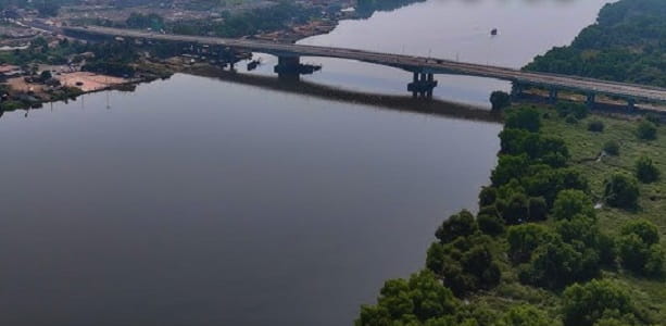
Mankoli Bridge — officially the Motagaon–Mankoli Bridge, also known as the Mankoli–Dombivli Bridge — is the most important new road infrastructure project in the Mumbai Metropolitan Region’s central corridor, a landmark 980-metre six-lane bridge over the Ulhas Creek that connects Motagaon village in Dombivli (Kalyan-Dombivli Municipal Corporation) to Mankoli village in Bhiwandi (Thane District), built by the Mumbai Metropolitan Region Development Authority (MMRDA) at a cost of ₹224 crore and now operational for public transport. The bridge’s completion has achieved what was once considered a fundamental structural deficit in the MMR’s connectivity matrix — for decades, Dombivli residents commuting to Thane had no choice but to navigate the heavily congested Kalyan–Shilphata–Thane route, a journey that routinely took 1 to 2 hours during peak traffic. The Mankoli Bridge has reduced this commute to just 15 to 30 minutes — a transformation that has been immediately and profoundly felt by lakhs of daily commuters travelling between Dombivli, Kalyan, Bhiwandi, Thane, and Mumbai’s northern suburbs.
The bridge is part of the broader Mankoli–Motagaon Link Road (MMLR) project that starts at NH-3 near Mankoli village (Km 553.300 of NH-3) and terminates at Motagaon village in Dombivli. Once fully developed and connected to the proposed Kalyan Ring Road, the bridge will serve as a critical link in diverting traffic flow from NH-160 and NH-8 to the Khopoli (NH-4) via the ring road — a regional highway restructuring that will ease congestion across the entire Kalyan–Bhiwandi–Thane triangle. Bhiwandi Road Railway Station is approximately 5 kilometres from Mankoli, providing suburban rail access, and the proposed Metro Line 5 (Thane–Bhiwandi–Kalyan Orange Line) will further enhance the zone’s public transit credentials when operational. The Mumbai–Nashik Expressway and Mumbai–Agra Highway are the two primary national highway lifelines of the Mankoli zone, ensuring seamless intercity road connectivity.
Mankoli Bridge Location
Mankoli Bridge spans the Ulhas Creek between Motagaon in Dombivli (KDMC area) and Mankoli village in Bhiwandi (Thane District) — positioned at the start of NH-3 near Km 553.300, off the Mumbai–Nashik Expressway, Thane District.
- Address: Mankoli Bridge (Motagaon–Mankoli Bridge), Thane–Dombivli Link Road, off Mumbai–Nashik Expressway, Mankoli Village, Bhiwandi Taluka, Thane District, Maharashtra — 421302
- Pin Code: 421302
- STD Code: 0250
- Administrative Zone: Bhiwandi Taluka — Thane District / Bhiwandi Lok Sabha Constituency / Bhiwandi Nizampur Municipal Corporation (BNMC)
| Reference Point | Distance |
| Mankoli Village | At the bridge |
| Motagaon Village (Dombivli side) | At the bridge |
| Mumbai–Nashik Expressway | Adjacent — direct access |
| Bhiwandi Road Railway Station | 5 kilometres |
| Kopar Railway Station | 5 kilometres |
| Dombivli Railway Station | 7 kilometres |
| Kalyan Junction Railway Station | 12 kilometres |
| Thane | 20 kilometres |
| Navi Mumbai | 28 kilometres |
| CSMIA Airport (Mumbai) | 30 kilometres |
| Mumbai | 35 kilometres |
| Nashik | 140 kilometres |
Directions to Mankoli Bridge
Mankoli Bridge is located on the Thane–Dombivli Link Road off the Mumbai–Nashik Expressway — accessible from Bhiwandi, Thane, Dombivli, Kalyan, and Mumbai via well-marked national and state highway approaches.
From Dombivli Railway Station
Take Motagaon Road westward from Dombivli → cross the Mankoli Bridge → approximately 7 kilometres — 15 to 20 minutes by auto-rickshaw or cab.
From Thane
Take NH-160 / Ghodbunder Road northward → connect to Bhiwandi Road → continue toward Mankoli → approximately 20 kilometres — 30 to 45 minutes.
From Mumbai (via Mumbai–Nashik Expressway)
Take the Mumbai–Nashik Expressway (NH-160) northeastward → exit at Mankoli village exit → approximately 35 kilometres — 45 to 60 minutes.
From Kalyan Junction Railway Station
Take Kalyan–Bhiwandi Road northwestward → approximately 12 kilometres — 20 to 35 minutes.
From Bhiwandi Road Railway Station
Take local roads toward Mankoli village → approximately 5 kilometres — 8 to 12 minutes by auto-rickshaw.
Road Connectivity Mankoli Bridge
Mankoli Bridge provides the most direct road connection between Dombivli and Bhiwandi — two of MMR’s most important residential and industrial hubs — dramatically reconfiguring the regional commuter map.
| Road | Direction | Connectivity |
| Mumbai–Nashik Expressway (NH-160) | West toward Mumbai | Mumbai city, CSMIA Airport, Thane, Mulund |
| NH-3 (Agra Road) | North toward Nashik / Agra | Nashik, Bhiwandi Bypass, NH-3 National Corridor |
| Thane–Dombivli Link Road | East toward Dombivli | Motagaon, Dombivli, Kalyan-Dombivli Municipal Corporation |
| Bhiwandi Road | South toward Bhiwandi | Bhiwandi town, industrial zones, logistics warehousing belt |
| Anjur Road | South | Anjur, Lodha Upper Thane, pipeline road corridor |
| Kalyan Bypass Road | East via Kalyan | Kalyan, Ambernath, Badlapur direction |
Bus and Transit Connectivity Mankoli Bridge
| Service | Details |
| Mankoli Bus Stop | Primary BEST / MSRTC boarding point at Mankoli village — Bhiwandi–Thane–Mumbai routes |
| Pawar Nagar Bus Station | Nearby MSRTC/BEST stop in the Mankoli zone |
| Anand Nagar Bus Depot | Bhiwandi zone bus depot — routes connecting Mankoli to Thane and Dombivli |
| Bhiwandi Bus Stop | MSRTC / private bus services to Mumbai, Nashik, Pune, Aurangabad |
| MSRTC State Services | MSRTC buses on Mumbai–Nashik Highway stop at or near Mankoli zone |
| Private Cab / Taxi | Available from Dombivli, Kalyan, Bhiwandi, and Thane stations to Mankoli Bridge |
| Auto-Rickshaw | Available at Mankoli village and Motagaon — primary last-mile mode |
Railway Connectivity Mankoli Bridge
| Station | Distance | Line | Notes |
| Bhiwandi Road Railway Station | 5 km | Central Railway — Vasai Road–Diva–Panvel | Nearest station — suburban trains |
| Kopar Railway Station | 5 km | Central Railway | Secondary nearby halt |
| Dombivli Railway Station | 7 km | Central Railway Main Line | Major suburban station — all CR trains toward CSMT |
| Kalyan Junction Railway Station | 12 km | Central Railway | MMR’s most critical suburban junction — all lines |
Metro and Future Connectivity Mankoli Bridge
Metro Line 5 (Thane–Bhiwandi–Kalyan / Orange Line) — currently under construction — will bring Metro connectivity into the Bhiwandi–Mankoli zone, providing a public transit alternative to the road bridge for daily commuters. The Mankoli Bridge works in tandem with the proposed Kalyan Ring Road, which will connect it to the broader MMR orbital highway network, and the Dombivli–Mankoli Flyover — an additional grade separator under construction that will further improve traffic flow at the bridge approaches.
Nearby Areas and Landmarks Mankoli Bridge
| Landmark / Area | Distance | Description |
| Bhiwandi | 5 km | Maharashtra’s largest textile and logistics hub — warehousing for e-commerce giants |
| Dombivli East | 7 km | Major residential zone — one of MMR’s fastest-growing housing markets |
| Lodha Upper Thane | 2 km | Massive integrated township development adjacent to the Mankoli zone |
| Kalyan Junction | 12 km | MMR’s most critical railway interchange |
| Tikuji-ni-Wadi | 15 km | Popular amusement and water park |
| Global Vipassana Pagoda | 20 km | One of Seven Wonders of Maharashtra — Buddhist monument |
| Thane | 20 km | Thane city — Upvan Lake, Yeoor Hills, IT parks |
| CSMIA Airport (Mumbai) | 30 km | Chhatrapati Shivaji Maharaj International Airport |
Frequently Asked Questions (FAQs)
Q1. Where is Mankoli Bridge located in Maharashtra?
A: Mankoli Bridge (Motagaon–Mankoli Bridge) is on the Thane–Dombivli Link Road off the Mumbai–Nashik Expressway, Mankoli Village, Bhiwandi Taluka, Thane District — PIN 421302 — connecting Motagaon in Dombivli to Mankoli in Bhiwandi over the Ulhas Creek.
Q2. How much time does Mankoli Bridge save?
A: The bridge reduces the Dombivli–Thane commute from the earlier 1 to 2 hours (via Kalyan–Shilphata) to just 15 to 30 minutes — a saving of 45 minutes to 1.5 hours for daily commuters on the Dombivli–Bhiwandi–Thane corridor.
Q3. Which railway station is nearest to Mankoli Bridge?
A: Bhiwandi Road Railway Station and Kopar Railway Station are both approximately 5 kilometres from the bridge — the nearest suburban rail access points. Dombivli Station is 7 kilometres on the opposite side of the bridge.
Q4. Is Metro available near Mankoli Bridge?
A: Not yet. Metro Line 5 (Thane–Bhiwandi–Kalyan Orange Line) is under construction and will bring Metro connectivity to the Bhiwandi–Mankoli zone once operational, significantly enhancing public transit options at the bridge.
Q5. What major projects are near Mankoli Bridge?
A: Lodha Upper Thane township is approximately 2 kilometres away. The proposed Kalyan Ring Road and Dombivli–Mankoli Flyover will further improve the bridge’s approach roads, and Metro Line 5 construction is underway in the broader corridor.